Meet the Meteorologist
What's your favorite weather phenomena?
What got you interested in the weather?
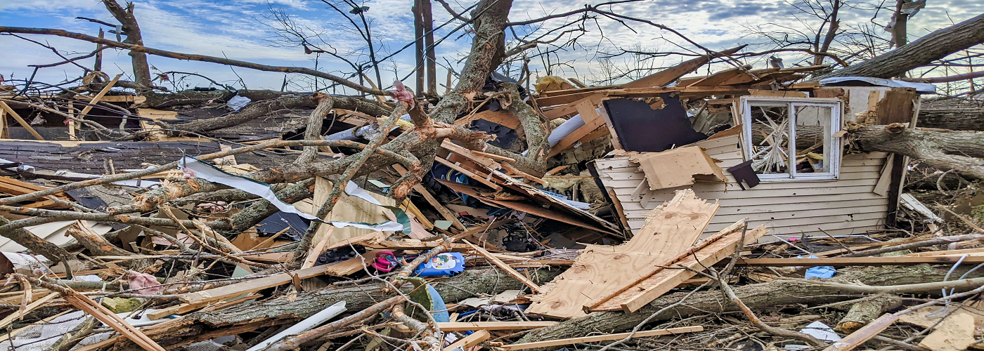

In May of 2011, the city of Joplin, Missouri, was struck by one of the most destructive tornadoes in U.S. history. The EF5 tornado, with winds estimated above 200 miles per hour, carved a mile-wide path through the city, killing 161 people, injuring more than 1,000, and damaging or destroying about 8,000 homes and businesses. The disaster caused more than $2 billion in damage and highlighted a major challenge in disaster response: assessing damage quickly enough to guide emergency aid and recovery efforts.
A recent study from researchers at Texas A&M University aims to dramatically speed up that process. The research team developed a system that combines remote sensing, artificial intelligence, and recovery modeling to rapidly assess building damage and estimate how long communities might take to recover after a tornado. Once post-storm images are available, the model can generate damage assessments and recovery forecasts in less than an hour.
The method relies on three key components. High-resolution satellite or aerial imagery provides a large-scale view of the affected area. Deep-learning algorithms then analyze the images, identifying signs of structural damage such as collapsed roofs, missing walls, or debris fields. Each building is automatically categorized according to damage severity, ranging from little or no damage to complete destruction.
The final component uses restoration modeling to estimate rebuilding costs and recovery timelines. By incorporating factors such as building characteristics, historical recovery data, and community resources, the system can simulate how quickly different neighborhoods may recover under various funding or policy conditions.
Researchers tested the model using extensive data from the 2011 Joplin tornado. In addition to accurately identifying damage levels, the system was able to reconstruct the tornado’s path based solely on damage patterns, closely matching historical records.
The team believes the technology could transform disaster response. By delivering near-instant damage assessments and recovery projections, the system could help emergency officials, insurers, and policymakers allocate resources faster and support communities as they rebuild.

 Paul Trambley
 Derek Heit
 Jennifer Wojcicki
 Laura Lockwood
 Ray Miller